
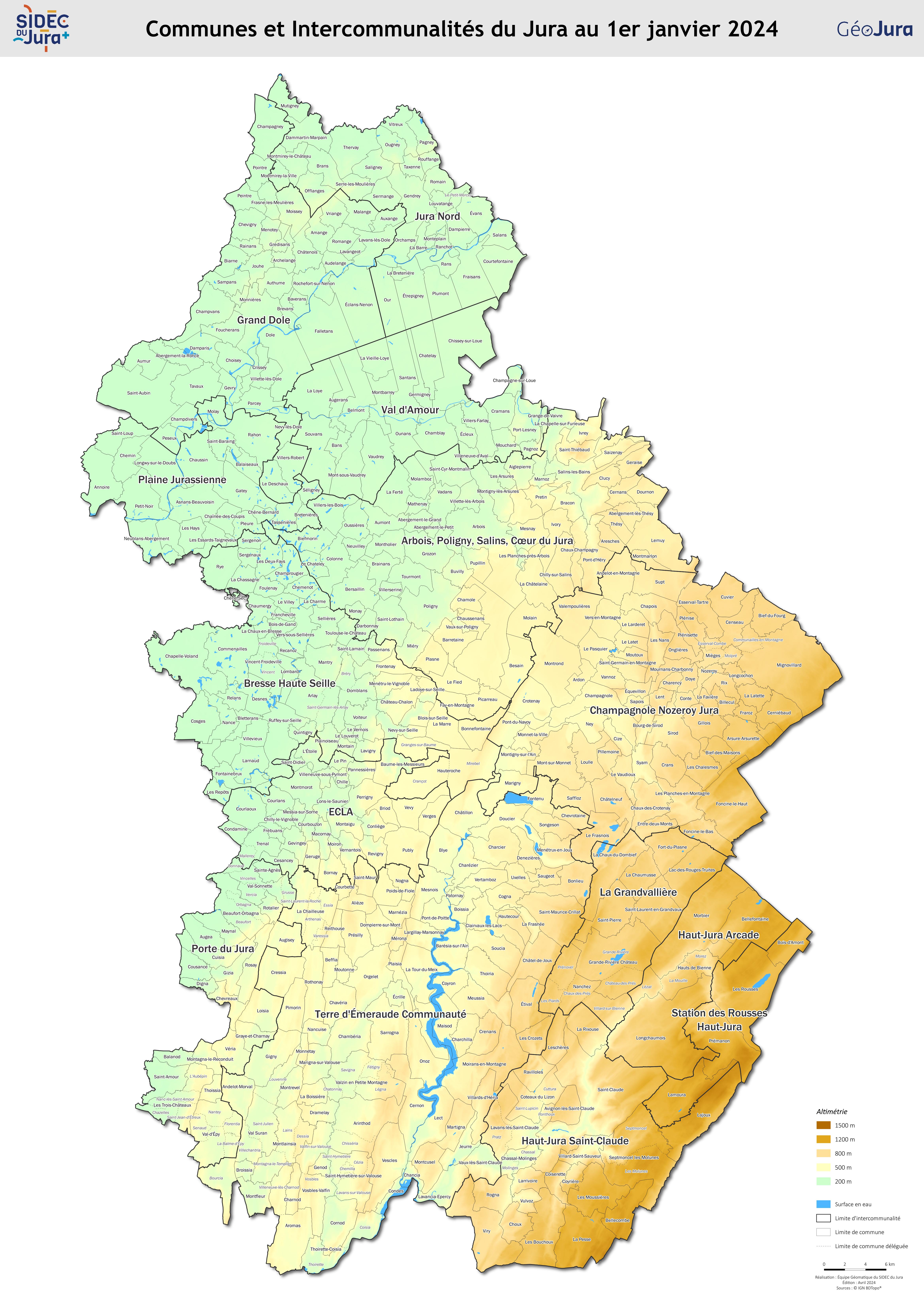
Carte administrative du Jura avec relief
Carte du découpage administratif du département du Jura (communes et intercommunalités) au 1er janvier 2025. Version relief.
|
|
Citation proposal
. Carte administrative du Jura avec relief. https://inspire.ternum-bfc.fr/geonetwork/srv/api/records/1a496bbc-3853-422f-9625-d75e34133850 |
Simple
- Date ( Creation )
- 2025-01-01
- Identifier
- 1a496bbc-3853-422f-9625-d75e34133850
Owner
- GEMET - INSPIRE themes, version 1.0
-
- Étendue géographique des données
- Keywords ( Theme )
-
- jura , Carte , relief , OpenData , Open Data
- Use limitation
- Données ouvertes
- Access constraints
- Other restrictions
- Other constraints
- Données ouvertes
- Spatial representation type
- Vector
- Metadata language
- French
- Topic category
-
- limites-administratives
- Hierarchy level
- Dataset
- Statement
gmd:MD_Metadata
- File identifier
- 1a496bbc-3853-422f-9625-d75e34133850 XML
- Metadata language
- French
- Hierarchy level
- Dataset
- Date stamp
- 2025-03-20
- Metadata standard name
- INSPIRE Metadata Implementing Rules
- Metadata standard version
- Technical Guidelines based on EN ISO 19115 and EN ISO 19119 (Version 1.2)
Owner
Overviews
Provided by

Views
1a496bbc-3853-422f-9625-d75e34133850
Access to the portal
Read here the full details and access to the data.
Associated resources
Not available